Gallery Title
Gallery Title
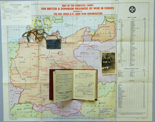
Map of the Principal Camps for British and Dominon Prisoners of War in Europe
Accession Number NWHRM : 5438.4
Description
A coloured, paper map published by the Red Cross and St. John War Organisation printed by Stanford, showing principal camps for British and Dominion Prisoners of War in Europe. The map concentrates on prisoner camps, civilian interment camps, and hospitals throughout Germany, Austria, and Poland. The map itself reaches from southern Lithuania in the Northeast corner, northern Hungary in the Southeast corner, sourthern Denmark and Sweden in the Northwest corner, and northern Switzerland in the Southwest of the map. There is an index of all camps, internment camps, and hospitals in the righthand side of the paper. A scale can be located near the bottom of the map with half an inch designated to twenty miles (.5in/20 miles). In the top corner, a note of corrections concerning locations to the map is listed.


